
A new series of Maps showing the Clare coastline, from Carrowmore has been developed by INFOMAR.
From Mutton Island to Georges Head, from Tullig Point to Loop Head and the Shannon Estuary, this new high-resolution map highlights the unique & intricate landscapes that lie beneath the waves.
INFOMAR (Integrated Mapping for the Sustainable Development of Ireland’s Marine Resource) has launched the Blue Scale Map Series; a collection of 18 high-resolution bathymetric maps of Ireland’s coastal waters. Developed by a dedicated team of hydrographers, data processors and cartographers, the maps highlight the topography of the coast in remarkable detail.
In 2006, the INFOMAR programme was established and is currently one of the world’s largest and leading seabed mapping programmes. Funded by the Department of the Environment, Climate and Communications, INFOMAR is a joint venture by the Geological Survey Ireland and the Marine Institute and aims to map Ireland’s seabed and deliver a comprehensive baseline bathymetry dataset to underpin the future management of Ireland’s marine resource.
Ireland’s coastline is approximately 3,171km in length and boasts some of the most unique & dynamic marine environments in Europe. The Blue Scale Map Series is the culmination of over a decade of work. Each week, INFOMAR will be releasing a new map of a different section of the Irish coastline.
The latest in the series is the bluescale bathymetric map of Loop Head, County Clare.
The area was first surveyed in 2009 on board the RV Celtic Voyager, with the INFOMAR team mapping a total of 162km2 of seabed along the River Shannon and west of Loop Head. Mapping continued in the region on board the RV Celtic Voyager, RV Keary, RV Geo & MV Cosantóir Bradán between 2011 – 2014, resulting in an area of over 2000km2 of previously unmapped Clare coastal waters being surveyed in high resolution. Earlier this year, INFOMAR’s inshore team, on board the RV Galtee, continued mapping shallower waters beneath the Iconic Cliffs of Moher, Liscannor Bay & Kilstiffin Reef.
Loop Head is on the north side of the River Shannon, in County Clare in the west of Ireland. The Loop Head peninsula has the Atlantic Ocean on one side, and the Shannon Estuary on the other, with barely a mile of land saving the prominent lighthouse at its tip from island status.
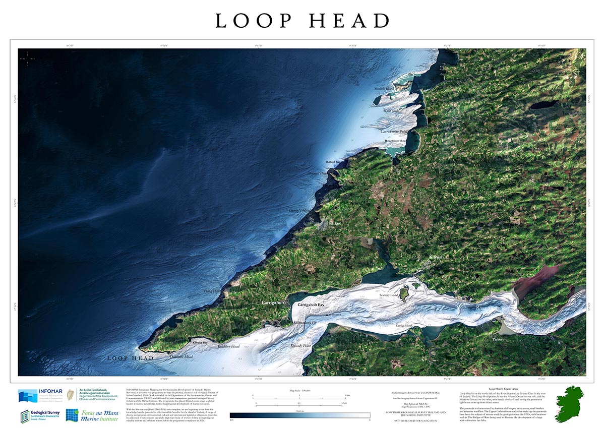
The peninsula is characterised by dramatic cliff-scapes, stony coves, sand beaches and estuarine mudflats. The Upper Carboniferous rocks that make up the peninsula have been the subject of intense study by geologists since the 1950s, with locations such as The Bridges of Ross being used to illustrate the development of a large-scale submarine fan delta.
Since 2006, INFOMAR’s seabed mapping efforts have been instrumental in enhancing our understanding of Ireland’s underwater landscape.
The Blue Scale Map series offers a new and unique way not only to showcase the mapping effort to date, but also to visualize and communicate complex scientific information to the wider public. As with all INFOMAR data, these high-resolution maps are available for free to download and have huge potential to communicate with local coastal communities and raise awareness on the importance of maintaining the health & integrity of our marine environment.
INFOMAR is making all 18 maps available for free to the public to download in high resolution JPEG format. Follow the journey each week as a new map is released on the INFOMAR website, and join the conversation on Twitter, Instagram & Facebook.