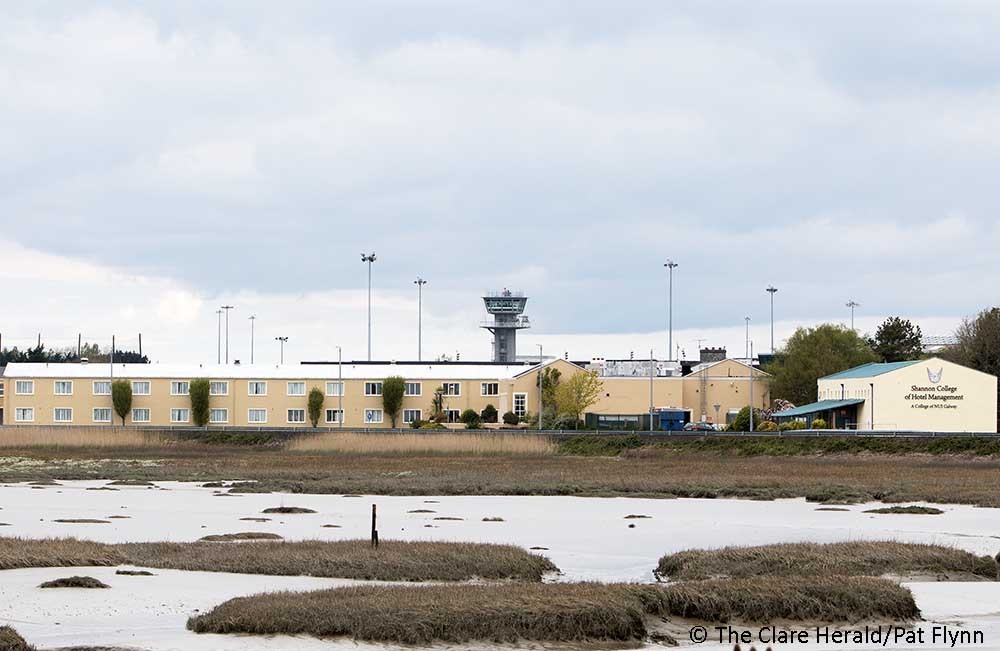
Clare could be one of the counties worst affected by coastal flooding as a result of climate change within the next 30 years with Shannon Airport also at risk.
An analysis by Gamma Location Intelligence has found that Dublin, Louth and Clare would be the most affected counties with some 88% of these addresses being residential, amounting to approximately 62,000 homes.
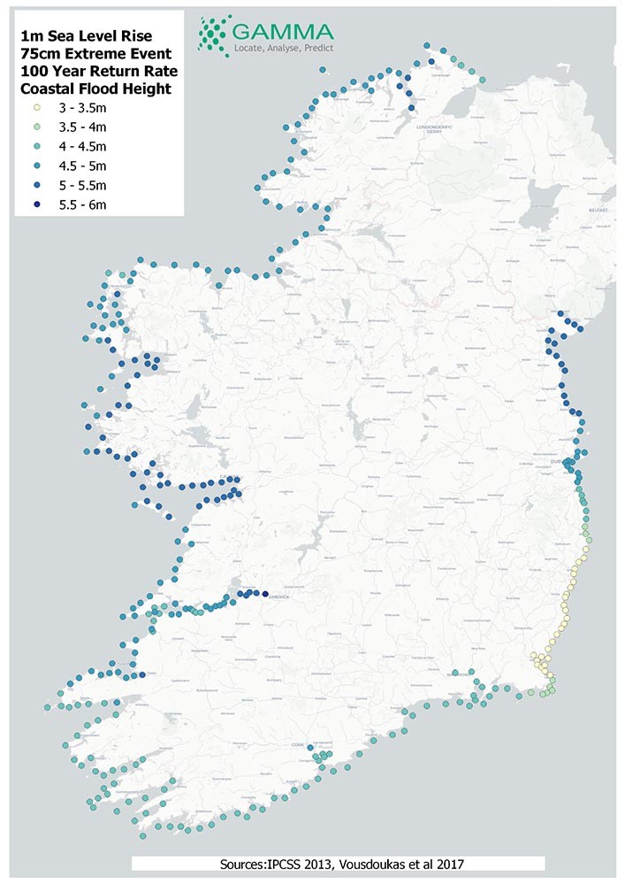
Graphics supplied by Gamma show how Shannon Airport and Shannon Town could be affected by flooded a risk previously identified by flood risk assessments. In 2018, Minister of State at The Office of Public Works & Flood Relief, Kevin ‘Boxer’ Moran visited Shannon town and the adjacent flood defence embankments fronting the Shannon estuary to announce plans to upgrade those defences and to construct new defences for Shannon town.
The analysis showed that Clare will be the third most affected county in terms of the number of addresses expected to be impacted by extreme coastal water levels, with some 7,376 homes and 1,320 businesses at risk.
Findings are based on predicted 2˚C rise in temperature, causing higher sea levels and more extreme weather events, leading to coastal flooding. This temperature increase is expected to happen by 2050, but could be delayed by reduction in carbon emissions.
Gamma Location Intelligence, which provides map and data analysis to insurance companies and local authorities for risk assessment purposes, has revealed that more than 70,000 Irish addresses will be at heightened risk of coastal flooding by 2050 as a result of climate change. Some 88% of these addresses are residential, amounting to approximately 62,000 homes.
The analysis showed that Dublin will be the most affected county in terms of the number of addresses expected to be impacted by extreme coastal water levels, with some 23,435 properties at risk. This translates as 21,513 residential addresses and 1,922 commercial properties.
Gamma Location Intelligence found that Louth (11,248) will be second most affected, with some 10,280 residential and 968 commercial properties predicted to be impacted, followed by Clare with 7,376 homes and 1,320 businesses at risk. Limerick (5,426) and Galway (4,501) rounded out the top five areas expected to be most impacted by increased flood risk as a result of climate change.
However, in terms of the proportion of addresses that are expected to be affected, Louth will be the worst with 19% of its addresses due to be impacted. The next highest is Clare (13.3%). In contrast, only 3.9% of Dublin’s addresses will be at risk.
These findings are based on a predicted global temperature increase of 2˚C* which climate scientists expect to happen in the next 30 years in some scenarios. This increase would cause sea levels to rise and bring about more extreme weather events, leading to higher and more frequent coastal flooding.
Gamma Location Intelligence mapped out the impact of this temperature increase utilising the Digital Terrain Model within its Perilfinder software platform. This solution assesses location risk for properties including flooding, fire, subsidence and crime.