The Tellus survey is undertaking the final phases of a national airborne survey over counties Kerry and Clare this year. When finished, the survey will be complete for the whole country, making Ireland one of the best geophysical mapped countries in the world.
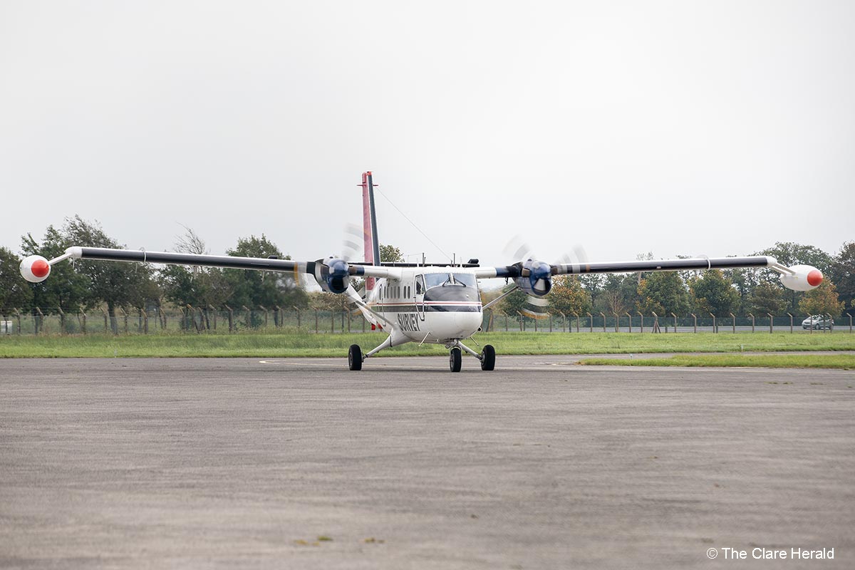
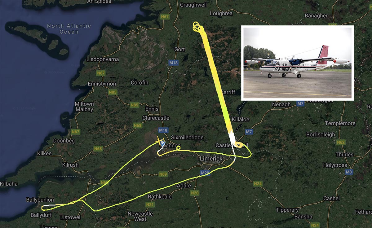
The survey takes off this spring with the two aircraft crossing the skies of counties Kerry and Clare. The aircraft fly at very low altitudes – 60m in rural areas – about eight times the height of a two-storey house – and 240m in urban areas, to allow them to make accurate measurements. The survey uses two aircraft, which are white, twin propeller planes. They are easily identified by their red tail and black stripe as well as the word ‘SURVEY’ and registration numbers C-GSGF & C-GSGP written across both sides of the plane.
Tellus is a national mapping programme managed by Geological Survey Ireland, a division of the Department of the Environment, Climate and Communications. The programme is collecting geochemical and geophysical data on rocks, soil, and water across Ireland. To gather this data, scientific equipment is fitted to a plane which flies in a grid pattern. In 2025, the survey planes will be based at Shannon airport under permit as approved by the Irish Aviation Authority.
Minister Darragh O’Brien said: “I will be delighted to see the survey aircraft back in the air to finish the final phases of the Geological Survey Ireland’s Tellus survey after 14 years of work. By the end of the survey, we will have flown all the far corners of the country and everywhere in between, collecting detailed geophysical data. The airborne data is being used to improve our geological maps and search for critical raw materials. By making all the data freely available, we can assist companies, state agencies as well as researchers in better understand the subsurface, in particular studies into radon gas, environmental pollution, agricultural productivity, and the extent of peatlands.”
The Tellus survey aims to have 100% of Ireland mapped by the end of 2025. The data has the potential to deliver positive economic, environmental, and agricultural benefits by helping to assist in understanding the local environment, soil management and natural resource potential for these counties and the whole country. Data collected throughout the Tellus project is published and made freely available to all on the Geological Survey Ireland website (Tellus).
Due to the low-flying altitude of the survey aircraft, anyone concerned about sensitive livestock is encouraged to contact the Tellus Freephone Information Line on 1800 45 55 65. The Tellus team will be happy to provide information on upcoming flight plans.
Geological Survey Ireland is Ireland’s National Earth Science Agency. It is responsible for providing geological advice and information, and for the acquisition of data for this purpose. It produces a range of products including maps, reports and databases and acts as a knowledge centre and project partner in all aspects of Irish geology. Geological Survey Ireland is a division of the Department of the Environment Climate and Communications (DECC) (www.gsi.ie).
The airborne survey is operated a Sander Geophysics Ltd De Havilland Canada DHC-6-300 Twin Otter aircraft on behalf of Geological Survey Ireland.
The aircraft carries a range of instruments on board for navigation purposes and to measure the geophysical properties of the ground.
The geophysical instruments on board the plane are:
- i) a magnetometer which measures the variations in the Earth’s magnetic field;
- ii) a gamma ray detector which measures the natural radioactivity of shallow soil and rocks;
iii) a frequency-domain electromagnetic (EM) system which measures variations in conductivity between different soils and rocks.
All instruments are safe and do not emit any radiation.
The navigation instruments include:
- i) a satellite navigation system;
- ii) a radar altimeter for measuring altitude;
iii) a video camera to record where the plane has flown for data quality purposes – video footage will not be used for anything else.
‘Tellus’ was the Roman goddess of the earth, also called Terra Mater.