Update:
Saturday, 1.44pm – Met Éireann has issued a new Status Yellow – Low Temperature/Ice warning for Ireland.
The new alert is an extension of two previous warnings and will remain in effect until 11.00am on Monday.
Met Éireann says there will be a very cold day and night time temperatures with frost and ice persisting in places.
The possible impacts of the cold spell include:
- Slippery conditions underfoot
- Hazardous travelling conditions
- Animal welfare issues
An Arctic airflow set to continue over the weekend and into the early days of next week. Persistently very cold night time and daytime temperatures bringing sharp to severe frosts and icy stretches on roads and footpaths. Dense fog forming in places with patches of freezing fog. Some showers of hail and sleet are expected too, falling as snow on higher ground.
Forecast
Tonight (Saturday)
Very cold tonight with widespread frost and icy stretches. Dry for most with just isolated showers, however, outbreaks of rain, with some falls of sleet on high ground, will push in early in the night, clearing eastwards by morning. Lowest temperatures of -3 to +1 degrees in mostly light variable breezes, falling calm at times allowing fog or freezing fog to develop.
Sunday
Another cold day with frost, ice and fog for many, slow to clear through the morning and lingering in some sheltered areas into the afternoon. A mainly dry day, away from the south coast which may have some outbreaks of light rain. Highest temperatures of 1 to 5 degrees in mostly light northeasterly breezes, increasing moderate later.
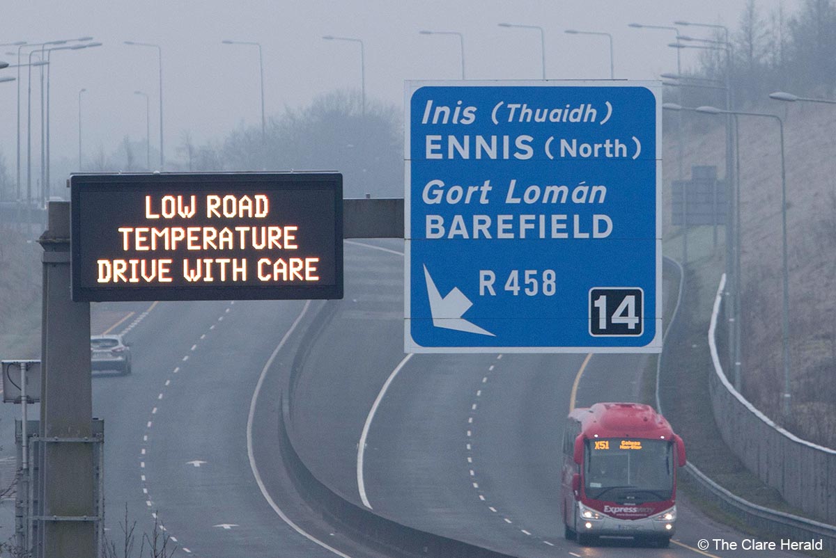
Saturday, 11.05am – Conditions are reported to be dangerous in many areas of the county particularly where roads are sheltered.
*Footpaths around Ennis town are also said to be slippy. Caution is urged.
*Drumcliff Road in Ennis is reported to be in a dangerous condition in places.
*Sections of the N85 are said to be treacherous. Rain has been falling on freezing surfaces. Caution is urged.
*Emergency services have dealt with a road traffic collision in Spanish Point.
Friday, 5.30pm – Met Éireann has also issued a Weather Advisory as well as a Status Yellow fog warning for Ireland
The weather service is warning that dense fog will form in many areas, lingering through the day in some places. Patches of freezing fog too. This could lead to poor visibility and hazardous travelling conditions
The warning, which came into effect at 5.00pm today, will remain in place until midday on Sunday.
Meanwhile, Met Éireann has issued a weather advisory on top of two Status Yellow low temperature/ice warnings this week.
An Arctic airflow is set to continue over the weekend and into the early days of next week.
Persistently very cold night time and daytime temperatures bringing sharp to severe frosts and icy stretches on roads and footpaths. Dense fog forming in places with patches of freezing fog. Some showers of hail and sleet are expected too, falling as snow on higher ground.
Met Éireann says further updates to warnings are expected in the coming days.
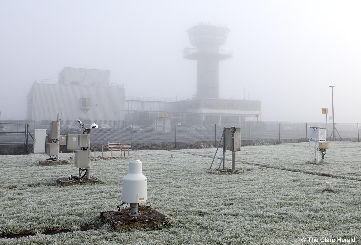
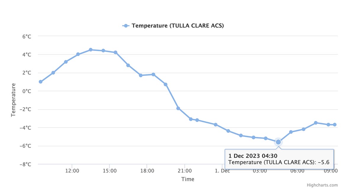
Friday, 9.30am – The temperature dropped to -5.6C at a weather monitoring station in Co Clare overnight.
Tulla Clare Automatic Climate Station (ACS), located near the village of Tulla, reported a temperature at 4.30am. At 9.30am today, the temperature at the station was still -4C.
The first of two Status Yellow temperature/ice warnings issued by Met Éireann, will expire at midday today (Friday). A second warning however will come into effect at 5.00pm today.
That warning will remain in effect until midday tomorrow (Saturday).
Met Éireann says it will get very cold with widespread frost and icy conditions, fog and freezing fog too and could result in hazardous conditions on roads and paths as well as travel disruption.
The Forecast (issued at 5.37am December 1st)
Friday
This morning any frost, ice, and mist or fog will gradually clear. Very cold and bright today with sunshine and isolated showers, with the possibility that some of the showers will fall as hail or sleet. Highest temperatures of 2 to 6 degrees in just a light variable breeze.
Tonight
Mostly dry overnight with isolated showers, possibly of sleet or snow. Very cold with lowest temperatures of 0 to – 4 degrees with a widespread sharp frost and icy patches. Mist and fog in parts too.
Saturday
Another cold day tomorrow with frost and ice to begin. Mostly dry through the day, with isolated showers. Highest temperatures of just 2 to 6 degrees in light west to southwest breezes.
Thursday, 2.15pm – The Met Éireann warning has been updated to include all counties of Ireland.
While the initial warning will expire at midday on Friday, another Status Yellow low temperature/ice warning will come into effect at 5.00pm on Friday and remain effective until midday on Saturday.
Met Éireann says it will be very cold with widespread frost and icy conditions. Fog and freezing fog too.
Possible Impacts include:
• Hazardous conditions on roads and paths
• Travel disruption
Earlier: Met Éireann has issued a low temperature/ice warning for most of the country including Clare.
The Status Yellow alert will come into effect at 6.00pm on Thursday and remain in place until midday on Friday.
Forecasters say it will be “very cold with temperatures expected to fall below -4 degrees in many areas. Frost and ice developing will cause hazardous travelling conditions.”
The affected counties include Clare, Carlow, Kildare, Kilkenny, Laois, Longford, Louth, Meath, Offaly, Westmeath, Wicklow, Cavan, Donegal, Monaghan, Cork, Kerry, Limerick, Tipperary, Connacht.
Today
Some frost or ice starting out on Thursday with a light dusting of snow locally. While many areas will be dry with sunny spells, a few well scattered showers will occur too, some wintry. Cold with highest temperature of 3 to 6 degrees. Rather brisk northeast winds will make for a wind chill factor, decreasing light later.
Tonight
Tonight will be very cold with a widespread sharp to severe frost and icy stretches. Dry and clear across most areas. Lowest temperatures of -1 to -4 degrees, with light northerly or variable breezes. Some patches of mist and fog also.
Tomorrow
On Friday morning, frost, ice, and any mist or fog will gradually clear. The first day of the meteorological winter will be very cold with well scattered wintry showers with a temporary dusting of snow possible locally. Overall dry though with sunny spells. Highest temperatures of 3 to 7 degrees with light to moderate northwesterly breezes.
Visit the Winter Ready website for safety advice.
Road Safety Authority severe weather advice.