
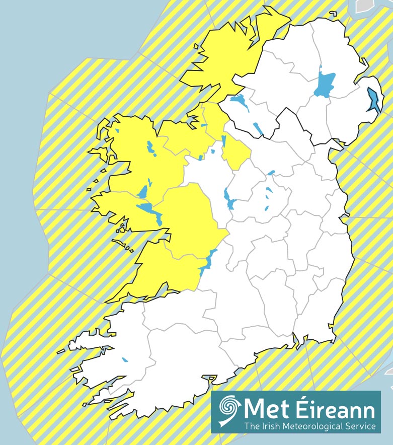
Update: The Status Yellow Rain Warning issued by Met Éireann Friday will now take effect at midday today (Sunday) and remain in place until 12.00noon on Monday.
The warning was due to come into effect at 8.00pm on Sunday and remain in effect until midday on Monday. The affected counties include Clare, Donegal, Galway, Leitrim, Mayo and Sligo.
Met Éireann now says the we can expect heavy rain from 1.00pm on Sunday while the period for the warning has also been extended by an hour to 1.00pm pm Monday.
The weather service is warning of heavy rain coupled with strong and gusty southerly winds, especially in exposed areas.
Potential impacts include localised flooding; damage to temporary structures; difficult travelling conditions and poor visibility.
It is possible that this warning will be amended or upgraded so it is advisable to monitor Met Éireann’s website or social media platforms.
*As of 11.00am on Sunday, three western counties have been place under Status Orange alert for Monday however this could be further amended to include other areas.
Forecast
Saturday – Sunny spells and scattered showers today. Highest temperatures 17 to 19 degrees in mostly moderate southwest to west winds.
Saturday Night
Largely dry early tonight with clear spells, cloud will thicken with rain and drizzle developing in the west of the province overnight. Lowest temperatures 11 to 13 degrees in mostly light to moderate southerly winds.
Sunday
Mainly dry to start on Sunday, there may be some light rain and drizzle in places near coasts. Rain is expected in the west again later. Highest temperatures 18 to 20 degrees with fresh and gusty southerly winds, strong near coasts.