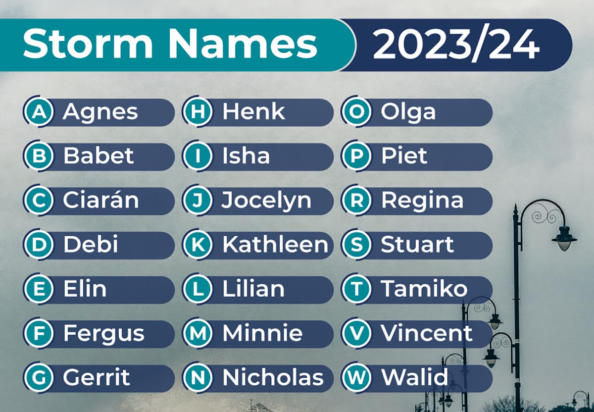
Updates:
Monday, 2.55pm – A Ryanair flight from Rome to Cork has diverted to Shannon Airport as high winds continue to affect the country.
While gusts of 65km/h have been reported at Shannon Airport, operations have not been affected. However, in Cork, winds have been gusting up to 78km/h forcing one flight so far to diver to Shannon.
The passengers will be transported to Cork by road.
Monday, 8.35am – A Status Yellow Wind Warning, due to expire at 4.00am today, has been extended until 7.00pm today (Monday).
Met Éireann has said we can expect very strong and gusty westerly winds, the potential impacts of which included large coastal waves with wave overtopping; difficult travelling conditions, debris and loose objects displaced.
Electricity
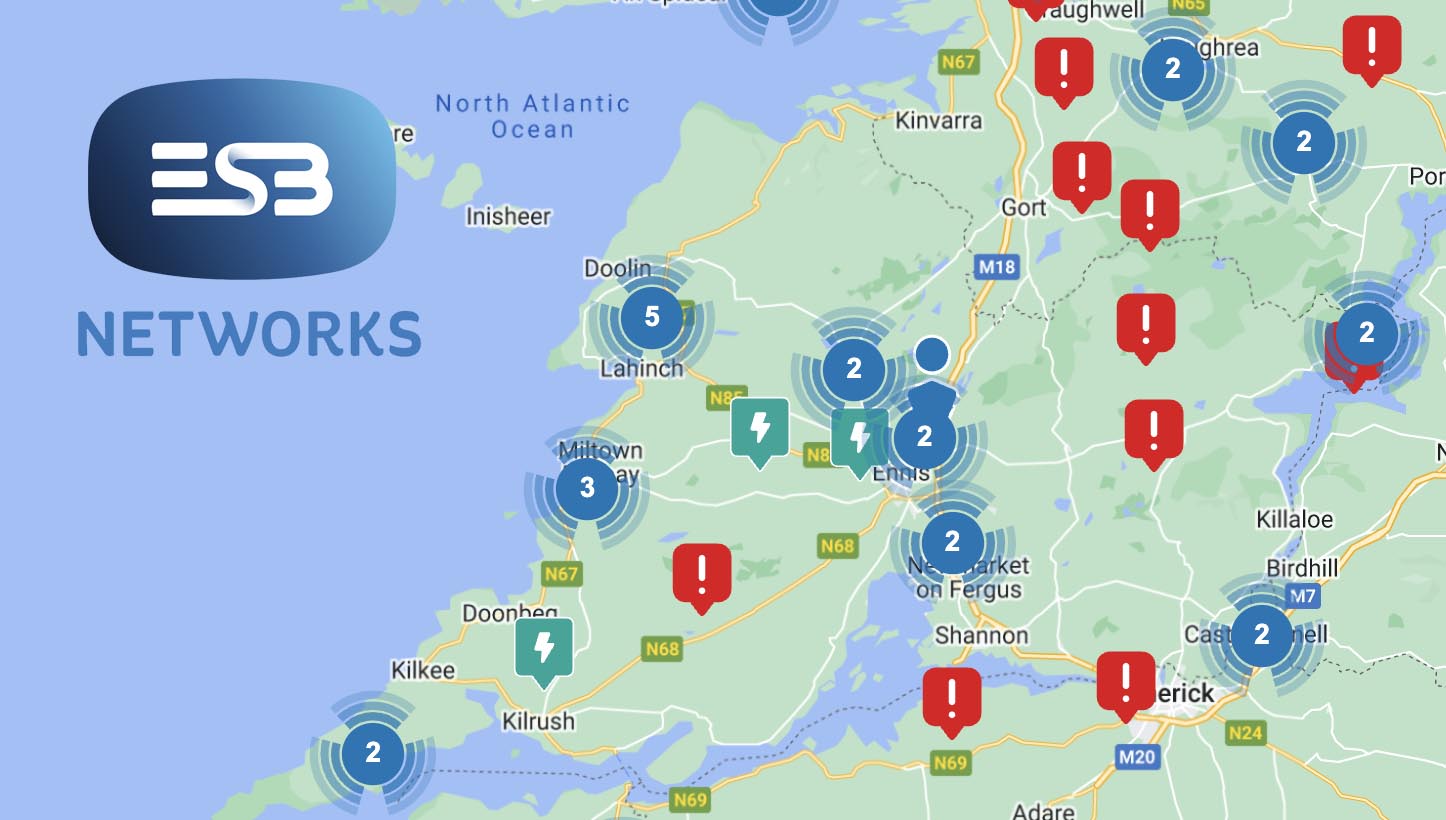
ESB engineers are continuing work to restore electricity to around 4,600 customers who were left without power overnight.
ESB Networks have said it’s aware that customers are experiencing power outages due to #StormIsha. If you’re currently without electricity, visit http://PowerCheck.ie to stay informed about estimated restoration times and updates.
Shannon Airport
Shannon Airport is expected to operate normally today after a busy day dealing with diversions yesterday. Despite the extremely high winds, with gusts of 109km/h reported, Shannon managed to operate normally accepted a total of 15 unscheduled services on top of its own arrivals and departures.
A Shannon Airport Group spokesperson confirmed: “Shannon Airport was fully operational yesterday and last night, operating our normal schedule and available to accept aircraft diversions throughout Storm Isha.
“Our airport staff worked tirelessly yesterday and throughout the night to facilitate flights impacted by Storm Isha, managing 15 flight diversions yesterday and overnight. We expect to operate a normal flight schedule today, and we remain available to facilitate further diversions if required.”
Flights from Portugal, Spain, France, Italy, Holland, Luxembourg, Poland, and the UK diverted to Shannon Airport during the course of the Storm. In total, ten flights due to land at Dublin Airport and four flights originally due to land at Cork airport diverted to Shannon. In addition, an Edinburgh bound flight which took off from Stansted diverted to Shannon at 02:37 this morning. All 15 flights landed safely.
Sunday, 9.21pm – Fire crews from stations across the entire county have been dealing with a variety of incidents this evening.
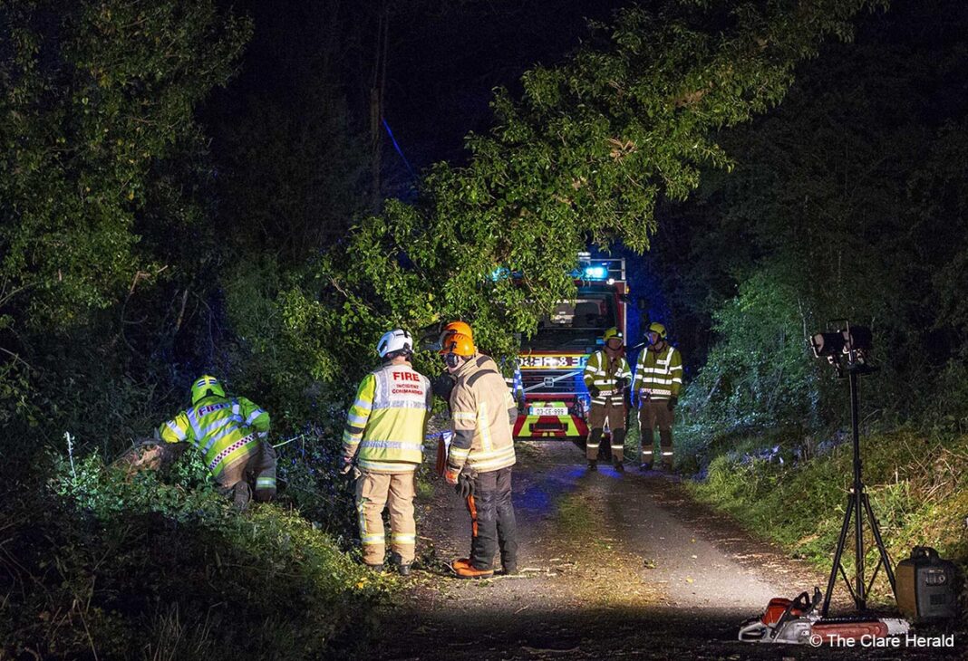
Firefighters from Ennis responded to an incident at Keevagh near Quin where an electricity pole was damaged in the storm. The R469 Ennis to Quin road was closed for a time as a result.
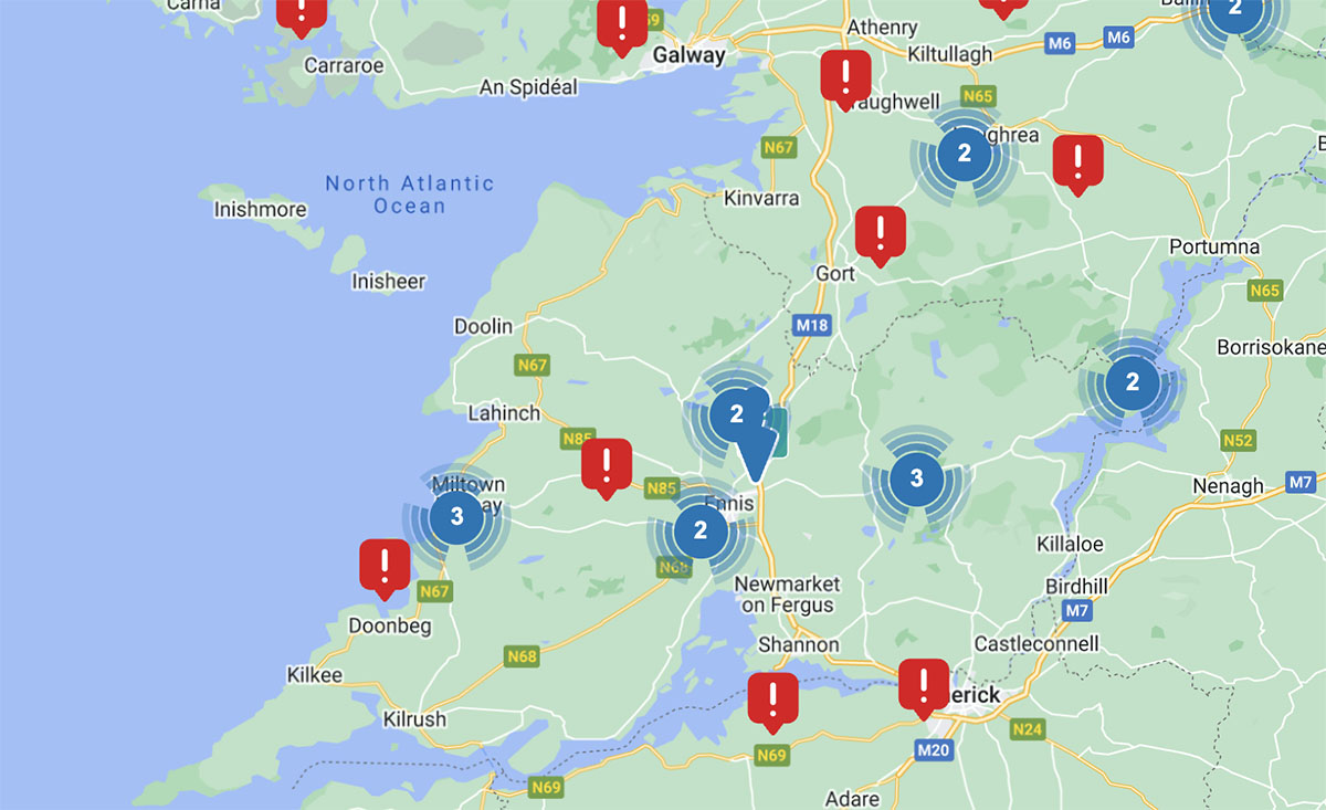
Sunday, 6.50pm – Thousands of customers across Clare have been left without power this evening as high winds continue to bash the county.
Power has been restored to 1640 customers in the Roslevan area of Ennis but many more customers are without electricity in the Ennis area, West Clare and North Clare.
For more information click here.
Sunday, 4.35pm – Shannon Airport has been accepting flights during the day after they were forced to divert from Dublin and Cork airports due to high winds.
Shannon Airport dealt with 10 diversions from Dublin Airport and a further 5 flights which were unable to land in Cork. The flights originated in Portugal, Spain, France, Italy, Holland, Luxembourg, Poland and the UK.
Despite winds gusting upto 109km/h at times in Shannon, the airport has managed to operate normally. Airport management are advising passengers to check with their airline for any schedule changes as there ‘may be some disruption to flights.
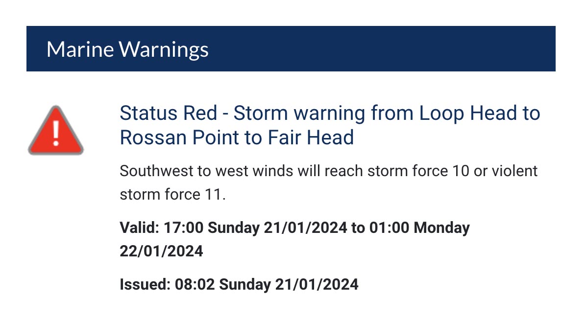
Sunday, 1.05pm – Status Red Storm warning from Loop Head to Rossan Point to Fair Head
Southwest to west winds will reach storm force 10 or violent storm force 11. The warning will be valid from 5.00pm on Sunday until 1.00am on Monday.
The National Directorate for Fire and Emergency Management (NDFEM) called a National Emergency Coordination Group meeting today with Met Éireann, the OPW, the local authorities, principal response agencies, key Departments and responding national organisations to prepare for Storm Isha
Speaking after the meeting, Paul Rock, Senior Assistant Fire Adviser in the NDFEM advised the public:
“Given the challenging wind conditions expected, I would urge members of the public to stay away from all coastal areas for the duration of the Met Éireann warnings.
“Travel in counties under a red warning is not advised until the alert has finished. Furthermore, all road users should only travel where necessary and be aware of the potential for hazardous travelling conditions. Motorists should slow down and be aware of the dangers of fallen trees and debris. High sided vehicles, cyclists and motorcyclists are particularly vulnerable during this time.
“Everybody is encouraged to keep mobile phones charged and at hand in case of emergencies and to check for updates where necessary.
“We will continue to monitor the ongoing weather conditions and ensure that all relevant state bodies are responding speedily and appropriately to meet any challenges. I would advise everybody to monitor national and local media, including social media, over the course of this evening and tomorrow to keep up to date with information regarding the developing weather situation.
“Above all, make sure you stay safe and keep in touch with vulnerable or elderly neighbours.”
ESB Networks
Customers can check estimated restoration times or report an outage on Powercheck.ie. Safety of public and crews is critical. ESB Networks will be making safe any faults which occur throughout the day and restoring supply remotely and on site when safe to do so.
Local Authorities
Local Authorities, who are the lead agency for the response to severe weather events on the ground, have activated their Crisis Management Teams and Local Coordination Groups and have been meeting and co-ordinating preparation for the arrival of Storm Isha – including readiness for restoring road networks following any weather disruption.
Transport
The Department of Transport is engaging with agencies and operators in preparation for any disruption to transport services and has initiated its severe weather protocol. The public are encouraged to use the relevant public transport provider websites to check for any disruption to services at local level.
Summary of advice
Stay away from all coastal areas for the duration of the Met Éireann warnings.
All road users should be aware of the potential for hazardous travelling conditions. Motorists should slow down and be aware of the dangers of fallen trees and debris. High sided vehicles, cyclists and motorcyclists are particularly vulnerable during this time.
It is critical that people never ever touch or approach fallen wires. Stay safe and stay clear of fallen or damaged electricity wires, and contact ESB Networks at 1800 372 999. Use the PowerCheck App to check for reconnection times.
Check transport websites for updates.
Check in on vulnerable neighbours.
Keep your mobile phone charged.
The NDFEM Crisis Management Team continue to monitor Storm Isha developments, liaising with Local Authority Severe Weather Assessment Teams and Crisis Management Teams who are actively monitoring the evolution of the storm.
Saturday, 9.10pm – Management at the Cliffs of Moher Visitor Experience have confirmed that the site will close at 2.00pm on Sunday while the county is under a Status Orange wind warning.
Earlier: Met Éireann has issued a Status Orange Wind Warning for Ireland for this Sunday as Storm Isha advances on the country.
The weather service says we can expect very strong southwest winds with severe and damaging gusts.
Met Éireann had originally issued a Status Yellow warning which has since been upgraded to Status Orange for some time. The Status Yellow alert will take effect at 11.00am on Sunday and remain in place until 4.00am on Monday.
However, the alert will then be upgraded to Status Orange from 5.00pm on Sunday until 2.00am on Monday.
The potential impacts of the windy conditions include large coastal waves with wave overtopping; very difficult travelling conditions; fallen trees and possible damage to power lines
Met Éireann has recommending checking their website for updates to warnings.
The Road Safety Authority (RSA) is asking road users to exercise caution while using the roads on Sunday 21 January and Monday 22 January as Met Éireann have issued Yellow Weather Warnings for Storm Isha where wet and windy weather is expected for Sunday where heavy rain will spread from the southwest and there will be strong to near gale force winds.
The following advice is being given to road users on foot of the weather warnings.
Motorists:
Drivers need to slow down and allow a greater braking distance between themselves and the vehicle in front in wet weather conditions. This is especially important on high-speed roads such as dual carriageways and motorways where there is increased danger of aquaplaning.
Take special care when driving behind goods vehicles, as they generate a considerable amount of spray, which reduces your visibility. Hold back to where you can see their mirrors.
If the road ahead is flooded, choose another route. Do not attempt to drive through it. Flooded roads that appear shallow could be deeper than you think. The verge may have subsided and there may also be trees or branches that have fallen that may not be visible.
Road users should always follow recommended routes and obey signs closing roads to traffic that have been put there by the local council or An Garda Síochána.
After going through water, drive slowly with your foot on the brake pedal for a short distance – this helps to dry the brakes.
Be Safe. Be Seen. Drive with dipped headlights at all times to ensure that you are visible and that you can see other road users.
Beware of objects being blown out onto the road. Expect the unexpected.
Watch out for falling / fallen debris on the road and vehicles veering across the road.
Control of a vehicle may be affected by strong cross winds. High-sided vehicles and motorcyclists are particularly vulnerable to strong winds
Drivers should allow extra space between themselves and vulnerable road users such as people cycling and motorcyclists as they may be blown off course by strong winds.
Pedestrians, people cycling, and motorcyclists:
Walk on the right-hand side of the road, facing traffic if there are no footpaths.
People cycling should ensure that they and their bike are visible to other road users by investing in a good set of front and rear lights (white at the front, red at the back) and by wearing clothes that help you be seen on your bike. Consider wearing high visibility material.
Take extra care when crossing the road or cycling in extremely windy conditions, as a sudden gust of wind could blow you into the path of an oncoming vehicle.
Be Safe. Be Seen. Visibility and light are reduced in poor weather conditions. Keep safe by making sure you can be seen. Wear bright clothing and consider wearing high visibility material.
For advice on severe weather driving tips, please see severe weather advice on the RSA website or check out the RSA Facebook and Twitter pages.
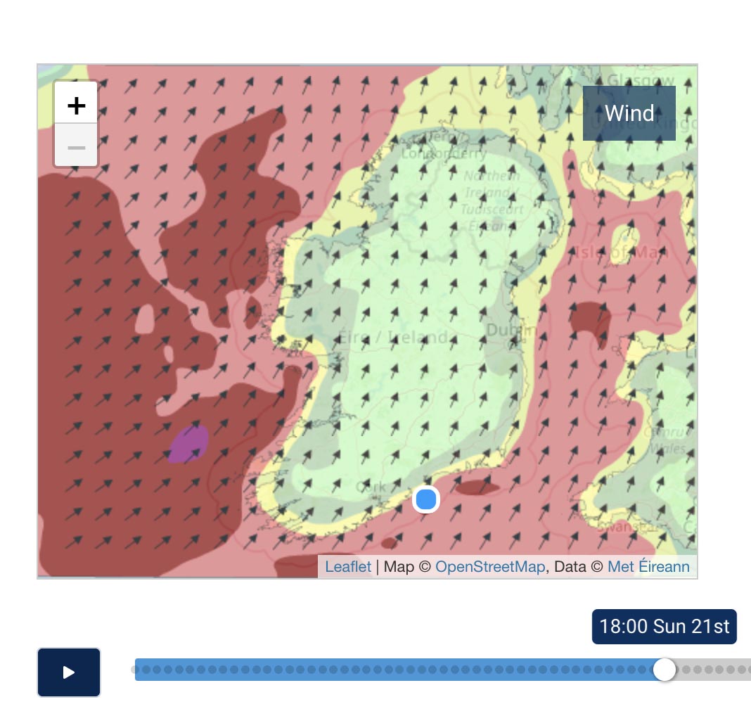
Sunday: Becoming wet and windy on Sunday with heavy rain spreading from the southwest and strong to near gale force and gusty southerly winds developing. Gales developing on some coasts also. Highest temperatures of 11 to 13 degrees.
Sunday night: Very windy and wet with very strong and gusty southwest winds and gales on coasts. Widespread heavy showers will gradually become more scattered overnight as winds veer westerly. Lowest temperatures of 3 to 7 degrees.
Monday: A blustery day with fresh and gusty westerly winds. Much brighter with sunny spells and scattered showers, some heavy with a chance of hail. Highest temperatures of 5 to 9 degrees.
