
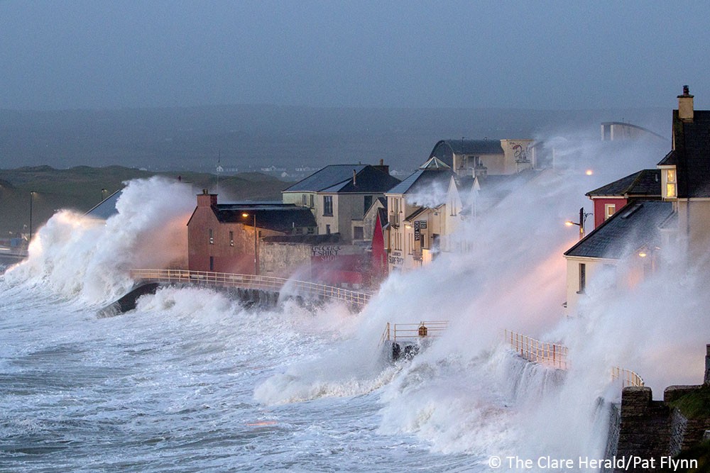
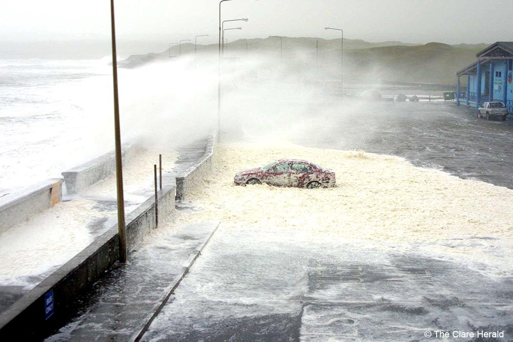
County Clare will remain subject to a Status Yellow wind warning until late tonight.
Met Éireann is warning that westerly winds associated with Storm Dudley will reach mean speeds of 50 – 65km/h with damaging gusts of 80 – 110km/h, stronger on exposed coasts and on high ground.
The weather service says a combination of high tide and strong winds will lead to a possibility of flooding on Atlantic coasts. Occasional heavy rain will also bring a possibility of spot flooding.
The Status Yellow alert will remain in place until 11.30pm today.
Clare County Council is advising the public to avoid coastal areas, take care when driving, and do not approach fallen wires.
Meanwhile, Met Éireann has issued Status Yellow wind, rain and snow warning for the whole of Ireland including Co Clare for Friday.
Following Storm Dudley on Wednesday, a separate low-pressure system named Storm Eunice will bring disruptive and challenging weather conditions on Friday, with impacts from strong winds, heavy rain and snow expected.
Storm Dudley will bring strong and gusty winds across Ireland on Wednesday, with gusts reaching around 80-110km/h especially in hilly areas and along exposed coasts. A yellow wind warning is in place across the country until midnight, with a risk of coastal flooding and also some spot flooding in areas from heavy rain.
A blustery day will follow on Thursday with a mix of bright spells and some heavy showers, before cloud, rain and strengthening winds arrive ahead of Storm Eunice. Met Éireann meteorologist, Matthew Martin, said:
“We’re keeping a very close eye on the forecast for Friday as Storm Eunice is expected to bring some challenging weather conditions, especially on Friday morning as strong winds, heavy rain and snow moves across the country.
“At the moment it looks like northern and western areas are most likely to see the heaviest snow falls, with southern areas expected to see the strongest winds, however we’re still a few days ahead and the details of when and where are likely to change. With this in mind, we’re urging people to keep a very close eye on the forecast and warnings for their area as these may change in the coming days.”
*For the most accurate and up to date forecast for your area on the Island of Ireland go to met.ie. The latest weather advisories and warnings for Ireland are on the Met Éireann Warnings page. These services and more are available on our free app – available from the App store for iPhone, and Play storefor Android.