Updates:
Sunday, 8.55pm
A total of thirteen flights had to diverted to Shannon Airport today as a result of stormy conditions at Cork and Dublin Airports.
Commenting, the Shannon Airport Group spokesperson said: “While all Shannon Airport services operated to schedule today, thirteen flights were diverted to Shannon Airport, seven originally due to land at Cork Airport six due at Dublin Airport.”
Sunday, 6.55pm
Debris on roadways including the N18 and M18 remains a problem. Surface has also been reported on the M18 between Dromoland and Newmarket on Fergus. Drive with care.
Sunday, 5.45pm
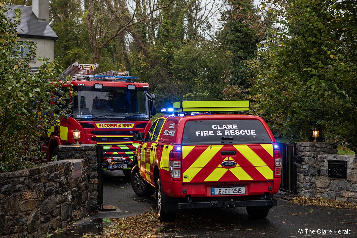
Fire crews from across the county have been responding to fallen or dangerous trees during the day.
Clare County Fire and Rescue Crews from Ennis station responded to a number of calls including in Larchill, Ruan, Daragh, Kilmaley and Ennis. One incident involved a tree that was found to be leaning dangerously close to a private residence in the Roslevan area of Ennis.
Shannon Fire Service dealt with a number of fallen trees and large branches on the N18.
Sunday, 1.45pm
Power
– There have been further power outages across the county this afternoon.
Almost 900 people in the Lisdoonvarna area of North Clare are affected while over 430 customers in the Kilnamona, Toonagh and Dysert areas are without electricity. *Power has since been restored.
Meanwhile, in the Clarecastle, Ballyea and Tiermaclane areas, a further 300 people are without electricity. *Power has since been restored.
– Power outages have been reported in the Tulla and Maghera areas where over 270 customers have been affected. Power is expected to be restored at around 1.00pm. *Power has since been restored.
– Power is also out in the Kilbaha where around 40 customers are affected. Power should be restored by 11.30am. *Power has since been restored.
The first electricity outage was recorded in the Moyasta area of South West Clare shortly before 1.00am. Around 500 homes are affected. *Power has since been restored.
See the ESB’s PowerCheck site for details for your area.
Sunday, 7.29am – The Status Orange Wind Warning for Clare which was due to take effect at midday today, will now be valid from 10.00am (two hours earlier).
A Status Yellow Wind Warning will remain in place until then and for a time after the Orange Alert has elapsed.
Sunday, 9.10am – Clare County Fire and Rescue Service crews from Ennis station have already dealt with downed trees in the Ruan, Daragh and Bushypark areas.
Debris, mainly small branches and leaves, has been reported on several routes so caution is urged.
Travel
Ryanair flight from Majorca, due in Shannon late last night, diverted to Cork. The flight repositioned from Cork to Shannon shortly after 3.00am.
A second flight from Malaga circled over Limerick and East Clare for almost an hour before it could safely land in Shannon.
Saturday, 6.10pm – Management at the Cliffs of Moher Visitor Experience have confirmed that as a result of the expected severe weather, “for the health and safety of our visitors and staff, the site will remain closed. Please do not visit.”
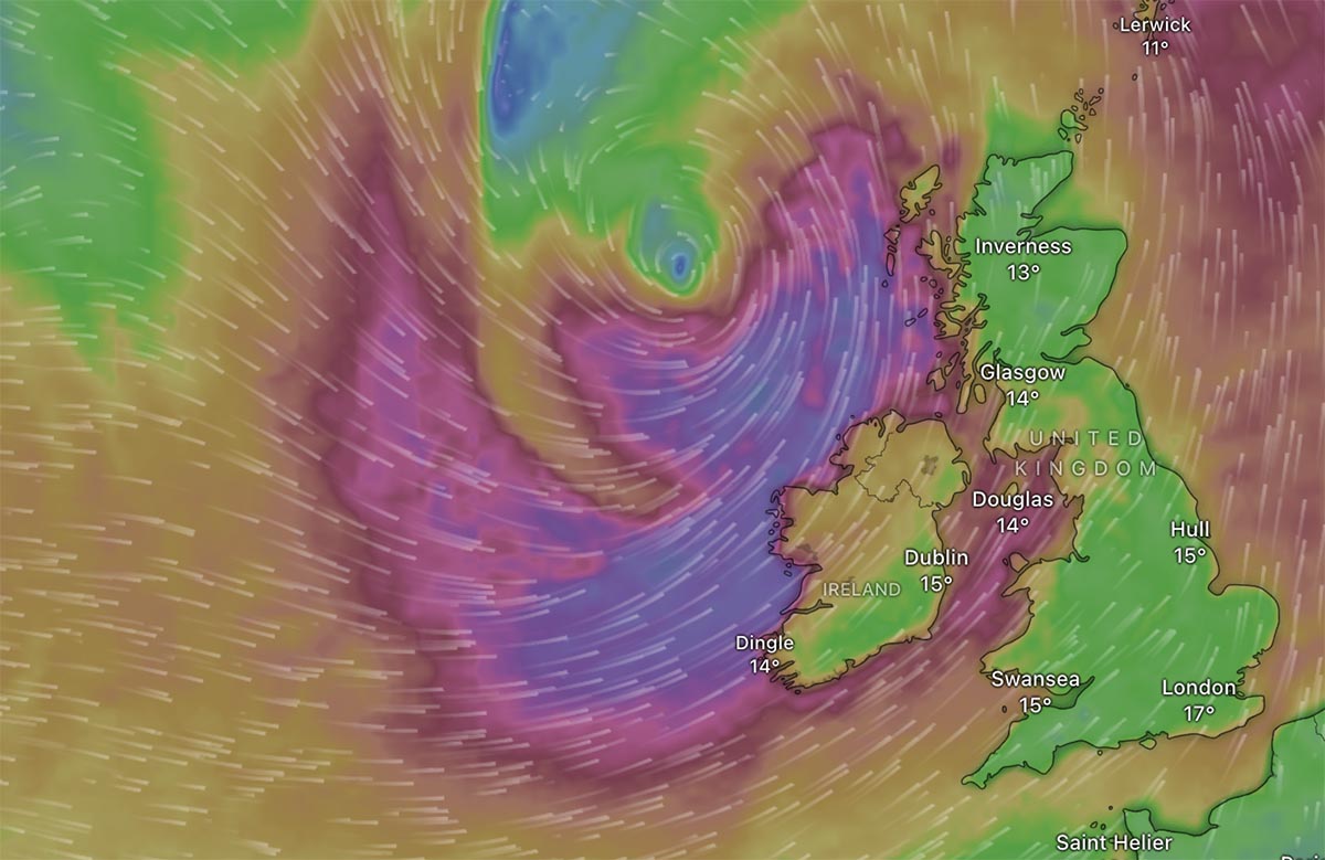
Saturday, 12.45pm – Met Éireann’s weather warning for Clare has been upgraded with the first named storm of the year expected to bring very strong and gusty winds.
Clare is now subject to a Status Orange Wind Warning along with counties Kerry, Galway, Mayo, Leitrim, Sligo and Donegal. A Yellow level warning had been issued earlier and will kick in in once the Status Orange warning has elapsed on Sunday night.
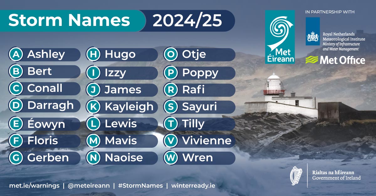
Forecasters say: “Storm Ashley will bring very strong and gusty south to southwest winds, coupled with high spring tides.
Met Éireann is warning of possible impacts which include:
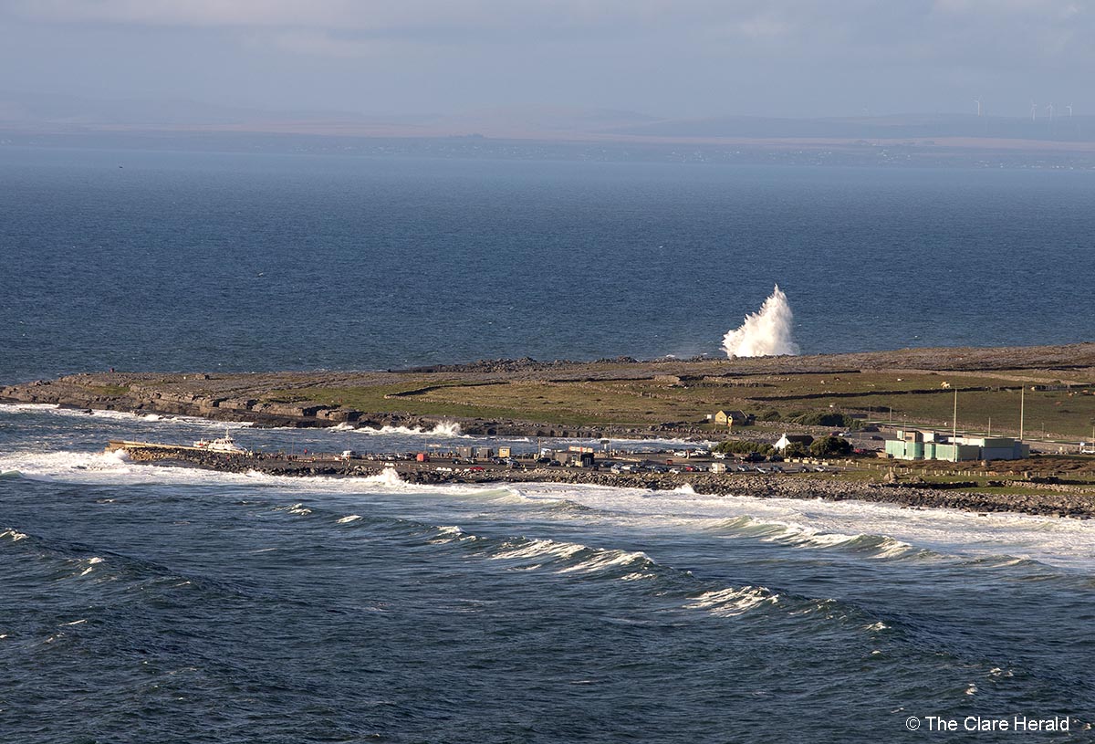
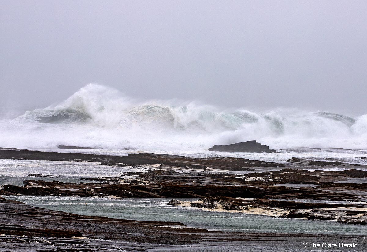
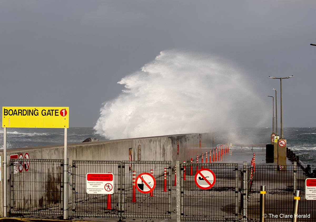
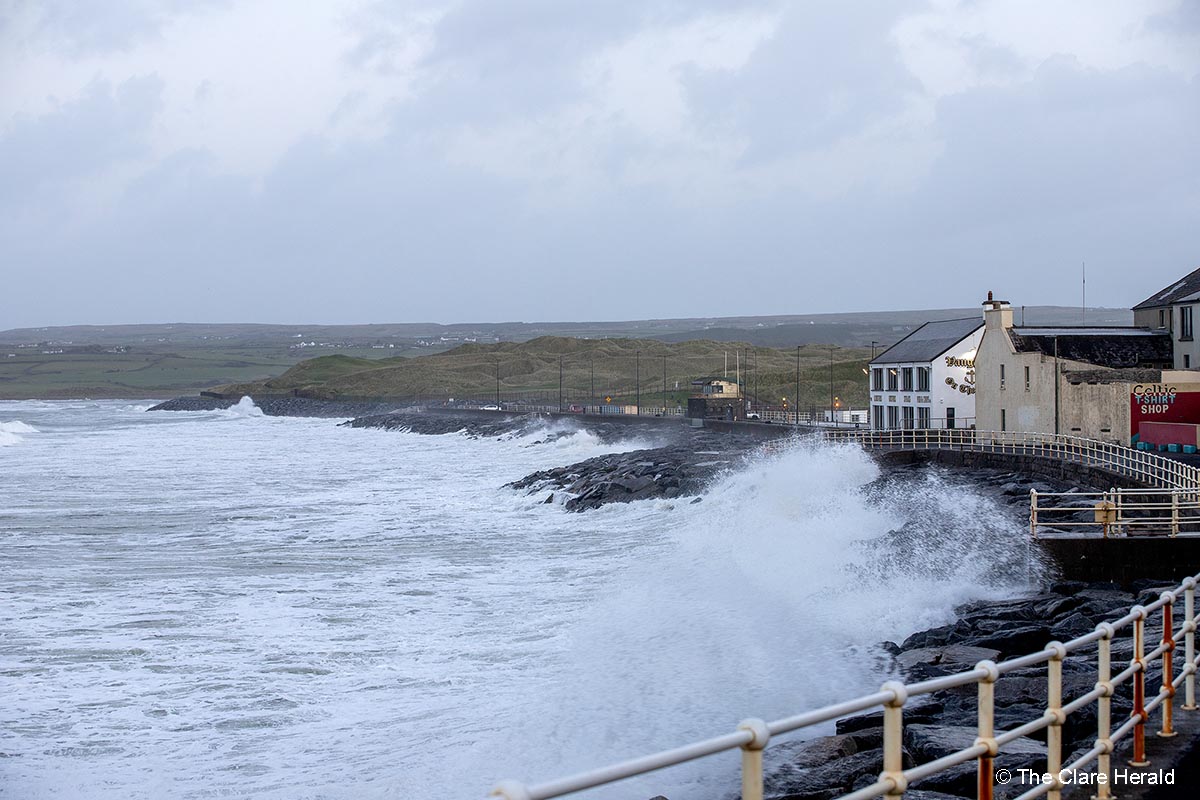
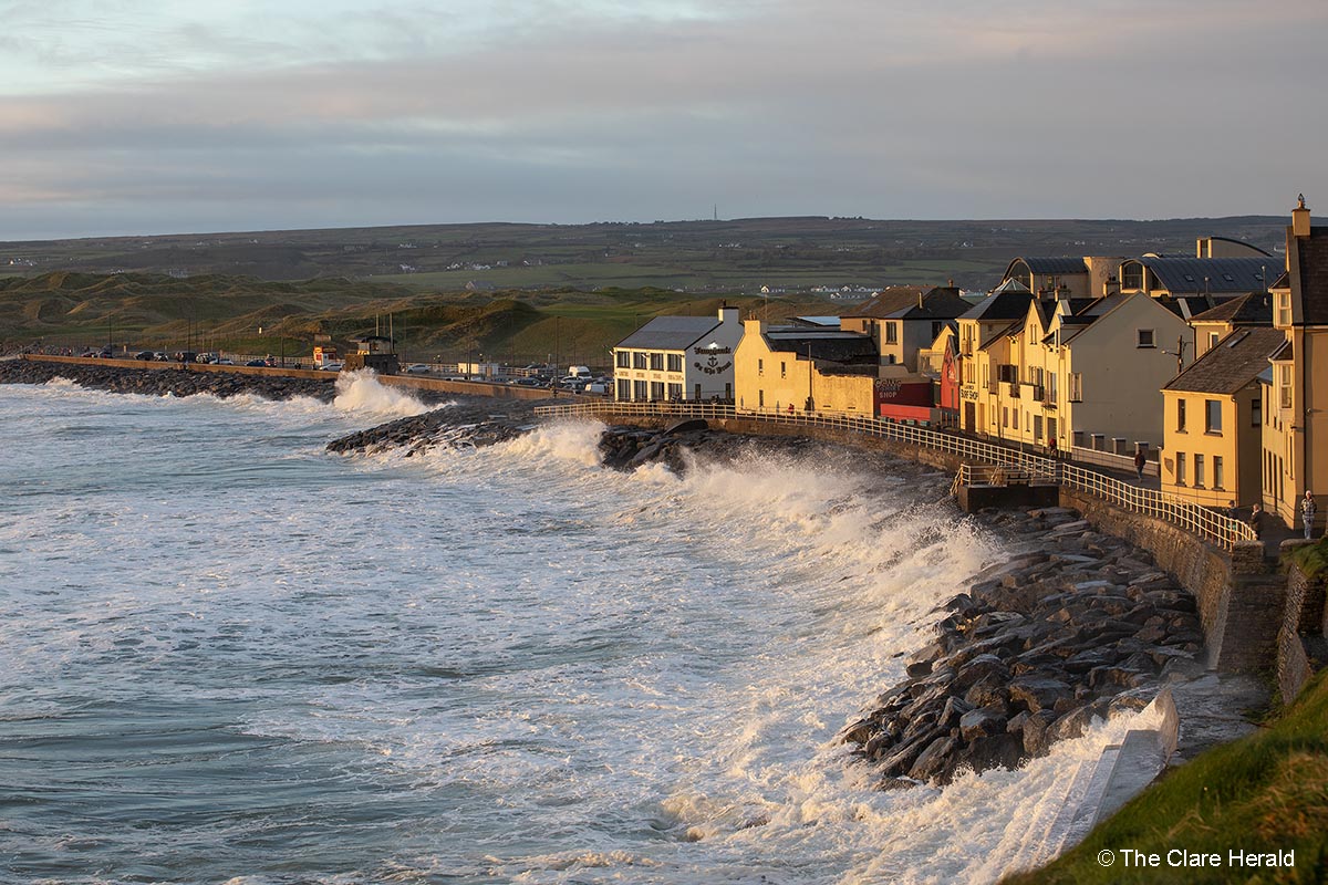
• Coastal flooding
• Large coastal waves
• Loose objects displaced
• Fallen trees
• Very difficult travelling conditions, dangerous conditions at sea
• Damage to power lines, power outages
• Damage to already weakened structures
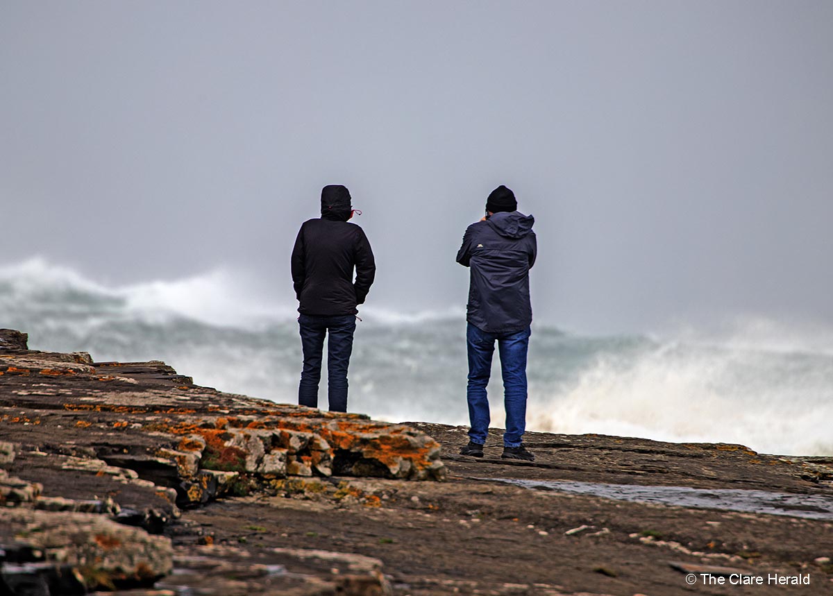
The National Directorate for Fire & Emergency Management (NDFEM) advised the public to stay away from coastal areas throughout Sunday due to adverse weather conditions. The warning followed a meeting this morning between the NDFEM, Met Eireann and various other stakeholders to review updates in relation to the current weather warnings in place for Storm Ashley.
Storm Ashley is forecast to bring strong and gusty southerly winds, with damaging gusts expected as well as high tides. Potential impacts include very difficult travel conditions, fallen trees, power outages, coastal flooding, and wave overtopping.
NDFEM will continue to liaise with Met Eireann and is monitoring the situation.
The new Orange warning will take effect at midday on Sunday and remain in place until 9 o’clock on Sunday night. The original Status Yellow Wind Warning will come back into effect and will last until 3.00am on Monday.
Keith Leonard, National Director of the National Directorate for Fire and Emergency Management, emphasised: “Local Authority Severe Weather Assessment Teams are continuing to monitor conditions locally. With potential for tidal flooding in coastal areas, especially in Southern and Western counties, surface flooding in urban locations is also possible and Local Authorities have their emergency response teams in place, ready to respond where and when necessary.
“The public also have their own part to play. I would absolutely urge everyone to stay away from all coastal areas during this period and to heed the advice from the Irish Coast Guard to ‘Stay Back, Stay High, Stay Dry’. As dangerous travelling conditions are also possible, road users should pay particular attention to the risk posed by fallen trees and flying debris.”
in Lahinch on Thursday evening
Saturday, 6.50am – Met Éireann’s Status Yellow Wind Warning for Co Clare will come into effect at 6.00am on Sunday as the first named storm of the year nears Ireland.
Forecasters say Storm Ashley will bring strong and gusty southerly winds, coupled with high spring tides.
The possible impacts of the expected weather included coastal flooding; large coastal waves; some fallen trees, branches; difficult driving and cycling conditions; debris and loose objects being displaced.
The warning will take effect at 10.00am on Sunday and remain un place until midnight.
A Status Orange Wind Warning has been issued for Galway and Mayo, worth keeping in mind if you have plans to travel in the directs on Sunday.
Keith Leonard, National Director of the National Directorate for Fire and Emergency Management, emphasised: “I would urge the public to stay away from coastal areas during this period and to heed the appeal from the Irish Coast Guard for people to ‘Stay Back, Stay High, Stay Dry’.
“Also, dangerous travelling conditions are possible and road users should pay particular attention to the risk posed by fallen trees and flying debris as trees are in full leaf. There is a potential for tidal flooding in coastal areas, especially in Southern and Western counties. In addition to this, heavy persistent showers are expected, which in turn may lead to surface flooding in urban locations.”
Further public safety advice includes:
People are advised to prepare for the arrival of the storm including ensuring their mobile phone is fully charged to enable communication.
Never drive through flooded roads, the depth of the water can be deceiving
Monitor Met Éireann forecasts and / or visit www.met.ie/ for the most up to date information. Information is available across social media platforms and other news media sources.
ESB Networks is highlighting the dangers posed by fallen live wires and is advising the public and the emergency services to stay away from these fallen cables and to report such cases to it immediately. ESB Emergency Services can be contacted at 1800 372 999. The public can monitor www.PowerCheck.ie regarding power restoration times.
The Road Safety Authority has issued the following advice ahead of the arrival of Storm Ashley.
Advice to Motorists
Drivers need to slow down and allow a greater braking distance between themselves and the vehicle in front in wet weather conditions. This is especially important on high-speed roads such as dual carriageways and motorways where there is increased danger of aquaplaning.
Take special care when driving behind goods vehicles, as they generate a considerable amount of spray, which reduces your visibility. Hold back to where you can see their mirrors.
If the road ahead is flooded, choose another route. Do not attempt to drive through it. Flooded roads that appear shallow could be deeper than you think. The verge may have subsided and there may also be trees or branches that have fallen that may not be visible.
Road users should always follow recommended routes and obey signs closing roads to traffic that have been put there by the local council or An Garda Síochána.
After going through water, drive slowly with your foot on the brake pedal for a short distance – this helps to dry the brakes.
Be Safe. Be Seen. Drive with dipped headlights at all times to ensure that you are visible and that you can see other road users.
Beware of objects being blown out onto the road. Expect the unexpected.
Watch out for falling / fallen debris on the road and vehicles veering across the road.
Control of a vehicle may be affected by strong cross winds. High-sided vehicles and motorcyclists are particularly vulnerable to strong winds
Drivers should allow extra space between themselves and vulnerable road users such as people cycling and motorcyclists as they may be blown off course by strong winds.
Advice to road users e.g. pedestrians, cyclists and motorcyclists:
Walk on the right-hand side of the road, facing traffic if there are no footpaths.
People cycling should ensure that they and their bike are visible to other road users by investing in a good set of front and rear lights (white at the front, red at the back) and by wearing clothes that help you be seen on your bike. Consider wearing high visibility material.
Take extra care when crossing the road or cycling in extremely windy conditions, as a sudden gust of wind could blow you into the path of an oncoming vehicle.
Be Safe. Be Seen. Visibility and light are reduced in poor weather conditions. Keep safe by making sure you can be seen. Wear bright clothing and consider wearing high visibility material.
Thursday: Yesterday Met Éireann’s Weather Warning Alerting Service issued an advisory for this weekend which could see high winds and coastal flooding.
The weather service has also said we can expect weather warnings to be issued tomorrow for the weekend. In the meantime, Met Éireann is advising that an exceptionally high supermoon with spring tides could result in coastal flooding possible. Wind warnings expected Saturday night and into Sunday.”
“This Friday, a brief period of heavy rain and strong winds across the country is expected. We are monitoring another low-pressure system which could undergo rapid deepening on Saturday with the potential for strong winds and potentially a named storm; however, uncertainty still exists about this event.”
Additionally, we are currently in one of the highest Spring tides of the year and this, tied in with any strong winds and high waves will increase the risk of coastal flooding.
Weather warnings for Saturday/Sunday, related to the Advisory issued for Ireland today, will be issued starting tomorrow, Friday 18th October, when Met Éireann’s high–resolution model provides an updated situation about the evolution of the low pressure system, and our meteorologists analyse it.
Weather warnings for Saturday/Sunday, related to the Advisory issued for Ireland today, will be issued starting tomorrow, Friday 18th October, when Met Éireann’s high–resolution model provides an updated situation about the evolution of the low pressure system, and our meteorologists analyse it.”