Updates:
- Gardaí issue public warning head of Red Storm Éowyn
- Clare County Council prepares for Storm Éowyn
- Storm Éowyn – Your Rights if flights cancelled/delayed
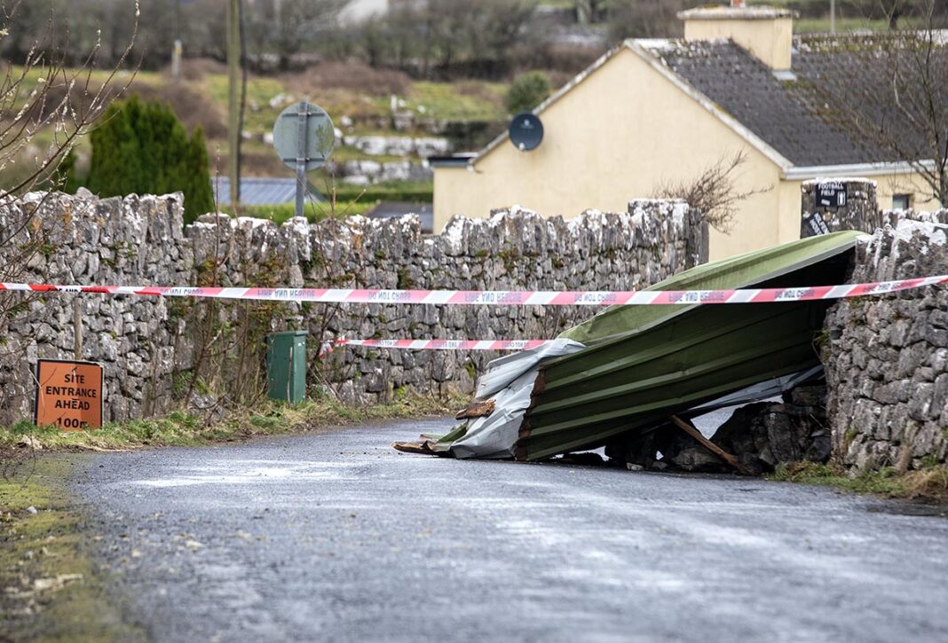
Friday, 5.45pm – Council update on civic amenities in Ennis.
John O’Sullivan Park, Lee’s Road, Ennis, will remain closed this Saturday, January 25. Assessment works continue in the aftermath of Storm Éowyn.
Active Ennis Leisure Complex re-opens tomorrow at the normal hours. Note that the exit road from the complex is cordoned off due to a fallen tree.
Please drive carefully.
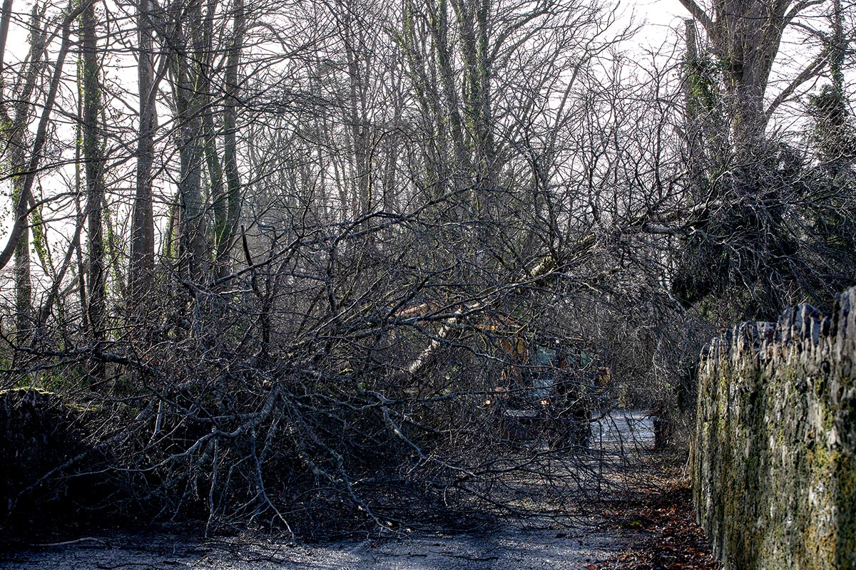
Friday, 3.45pm – Fallen trees and debris have reported on most routes around the county.
- Clare County Council crews and Clare County Fire and Rescue Service personnel have been working all day to clear the obstructions but it’s likely that not all incidents will be dealt with this evening.
- Stones from roadside walls have also been displaced causing a hazard.
- Heavy hail and snow showers have also been reported in North Clare.
- Mobile phone coverage has also been severely disrupted in many areas.
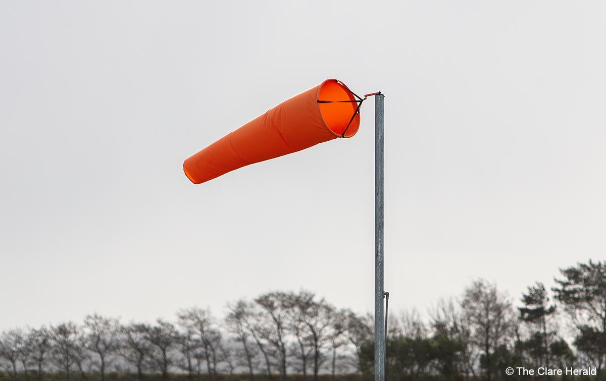
Friday, 5.58am – Gusts of over 137 kilometres per hour have been recorded at the Shannon Airport overnight.
A spokesperson for Shannon Airport said: “Due to the impact of Storm Éowyn, airlines have cancelled a number of flights scheduled to depart and arrive at Shannon Airport this morning. As a result, many of our morning flights have been cancelled or delayed.
“The advice for intending passengers is to contact your airline directly or refer to their airline website/mobile app. for the most accurate and up-to-date flight information. Airlines will contact passengers whose flights have been impacted as a result of the weather warnings.
“Shannon Airport remains open and our staff continue to monitor this extreme weather event. Our full schedule will resume once weather conditions permit.
“If your flight is impacted as a result of the weather warning, your airline will notify you directly in advance. Passengers are advised to check this before travelling to the airport.”
Further updates will be posted on Shannon Airport’s social media feeds over the coming hours.
Friday, 3.20am – County Clare is now officially under Status Red alert as Storm Éowyn takes hold.
Tens of thousands of homes and businesses are currently without power.
Visit ESB Networks’ PowerCheck portal for updates if you are affected.
If you have a working radio or mobile coverage, tune into your local radio station Clare FM or download the app for up-to date information.
Thursday, 10.06pm – Shannon Airport expects to be operational tomorrow (Friday) with some disruption expected as a result of Storm Éowyn.
To-date, two outbound flights due to depart Shannon Airport tomorrow morning have been cancelled, and two arriving flights have also been cancelled. This is a dynamic and evolving situation which we will continue to monitor.
We would ask intending passengers to contact their airline for the most up to date information before travelling to the airport.
The safety of our passengers and staff is our priority at this time. We appreciate the understanding and cooperation of our passengers and encourage everyone to stay safe during this extreme weather event.
Updates will be available on Shannon Airport’s social media channels during this weather event.

Wednesday, 4:45pm – The National Emergency Co-ordination Group (NECG) met today (Wednesday) as red level weather warnings have been issued for some counties and Storm Éowyn is forecast to bring very dangerous and destructive winds on Thursday night and Friday.
Schools, early learning and childcares settings and further and higher education institutions in red level warning areas will close for the duration of the red warning.
Employers in red warning areas should facilitate working from home for all employees who can do so. Only emergency service workers should be leaving home for work, where directed by their employer.
Widespread disruption to public and other services is to be anticipated.
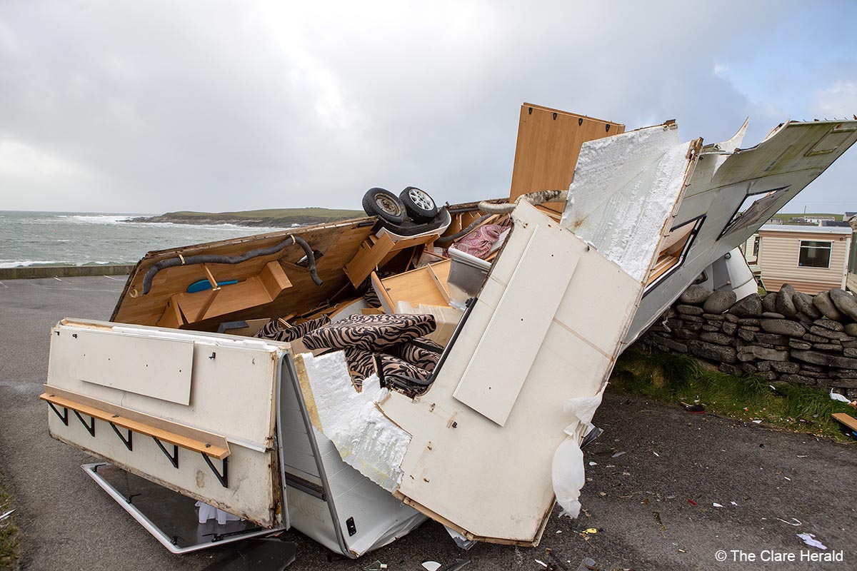
Wednesday, 11.15am – A spokesperson for The Shannon Airport Group has confirmed that it is business as usual today at Shannon Airport.
However, the airport team are preparing the airfield for the arrival of Storm Éowyn. According to the latest Met Éireann weather update, a status red weather warning will come into effect in County Clare from 03:00 Friday 24/01/2025 to 11:00 Friday 24/01/2025.
“Storm Éowyn could lead to some flight disruption on Friday and we would advise passengers to contact their airlines directly for information on their flight. Our team will continue to monitor the situation as it develops and are engaging with the relevant authorities to ensure a coordinated response.
We appreciate the understanding and cooperation of our passengers and encourage everyone to stay safe. Further updates will be posted on the airport’s social media channels throughout the storm event.”
Met Éireann has issued Status Red Wind Warning for Clare which will be followed by the previously issued Status Orange alert.
The higher level warning will come into effect at 3.00am on Friday and will remain in place until 10.00am while the mid-level alert will commence at 10.00am.
Forecasters say that ‘Red Storm Éowyn’ will bring gale force southerly winds becoming westerly will bring severe, damaging and destructive gusts in excess of 130km/h.
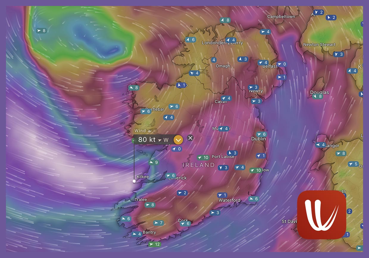
Data from weather website windy.com shows that winds could reach 80 knots (148km/h) or higher in West Clare on Friday morning
Cork, Kerry and Limerick have also been place under the Red warning.
The possible impacts of the storm include:
Danger to life
Extremely dangerous travelling conditions
Cancellation of events
Wave overtopping
Coastal flooding in low lying and exposed areas
Unsafe working conditions
Fallen trees
Significant and widespread power outages
Structural damage
Disruption and cancellations to transport
Once the Red Warning has elapsed, a Status Orange Wind Warning will remain in place until late Friday afternoon.
Met Éireann has warned of gale force southerly winds becoming westerly will bring severe, damaging and destructive gusts of up to 130km/h widely, with even higher gusts for a time.
These winds could result in:
Fallen trees
Damage to power lines and power outages
Structural damage
Very difficult travelling conditions
Disruption and cancellations to transport
Wave overtopping
The Status Orange warning will come into effect at 2.00am before the Red warning has elapsed. It will remain in place until 5.00pm on Friday.

Hurricane Hunters
A United States “hurricane hunter” aircraft and a team of storm chasers arrived in Ireland last weekend however the reason for the visit has to be confirmed.
The National Oceanic and Atmospheric Administration (NOAA) Lockheed WP-3D Orion, nicknamed “Kermit”, arrived in Ireland from Florida via Canada last Saturday however it’s not yet clear whether the visit is associated with this week’s storm.
The aircraft, which uses the callsign NOAA-42 is due to depart for Bilbao in Spain on Thursday afternoon.
NOAA previously sent the aircraft to Shannon in 2017, 2018 and 2020.
Marine
Meanwhile, Status Yellow Gale Warning has also been issued for all coasts of Ireland and on the Irish Sea.
Southeast winds will reach gale force 8 or strong gale force 9 on all Irish coastal waters and on the Irish Sea.
This warning will come into effect at 9.00pm on Thursday and remain valid until 2.00am on Friday.
This alert will be replaced by a Status Orange Storm Warning for all coasts of Ireland and on the Irish Sea.
Met Éireann is warning of southwest winds, veering westerly will reach Storm Force 10 on all Irish coastal waters and on the Irish Sea.
